July 29 - 30, 1999 - Longs Peak
via the Keyhole Route
Class 1, 2, & 3 Hiking/Climbing
Elevation on Longs Peak: 14,255
ft
Elevation gained: 4,855 ft;
Distance: 16 miles RT.
Hikers:
- Dan Edwards, Aspen
Park, CO
There are people who climb
the Longs in one day (16 hours on the average). Then there are
people who would camp at the foot of the Longs Peak before heading
to the summit the next day -- the way I prefer. So when Dan Edwards,
Phil's cousin and a member of the "team", told me about his plan
to camp out, I immediately joined him.
Then in late June, Phil
had a freak accident while hiking on Flattop Mountains and blew
his knee. Still, Phil was nice enough to keep the plan intact,
although he knew right then that the hardest part of the hiking
weekend would be looking at the mountain and wishing that he was
on it.
I arrived at Phil's home
the day before (despite a cancelled flight out of Kalamazoo, thanks
to Northwest Airlines) where I met Dan. We went out for a nice
pasta dinner and loaded ourselves with carbohydrates, like marathon
runners often do.
We left Longs Peak Ranger
Station around 2 p.m. on Thursday. I had a bit of a struggle to
catch up to Dan's speed, and I attribute that to a pair of his
long legs (actually, it was more of me being out of shape)..
We reached the Chasm Lake
trail junction at 3:30 p.m., where we took a few pictures and
rest. We hiked on, slowly but surely, heading for the Boulderfield.
At 5:45 p.m., we reached
the Boulderfield campground. There were nothing but large rocks
here, but the each campsite is mounded with soil, so the surface
is not as rough as it may look. Dan surveyed the campground quickly
and found a site that was furthest from the trail (noise protection)
and closest from the Keyhole, our next stop.
Neither of us slept well
that night. A stiff wind kept flapping our tent (and in turn,
slapping my face) all night long. To make the matter worse for
me, I was having headache and a bit of nausea from altitude sickness,
which felt just like a bad hangover. So I was glad when the morning
has finally arrived. After some stretching and getting fresh air,
I felt much better already.
With a cup of coffee and
a granola bar (that's about all I wanted to eat), we started up
the Boulderfield toward the Keyhole at 7:30 a.m. We chose our
trek carefully, hopping up the hill on the boulders. By 8:20 a.m.,
we arrived at the Keyhole, where Dan pulled out his cell phone
and called Phil. I hoped Phil and Debbie (Phil's wife) weren't
asleep.
***
The Keyhole marks a very
stark division in the hike to Longs Peak. Immediately after going
beyond the Keyhole, the hike becomes serious. Serious views. Serious
exposure. Serious elevation gain. It makes you work and it wants
you to pay attention.
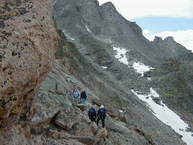
We did the ups and downs
of the Ledges, following the trail marked only by the line of
people and the fried eggs (red and yellow targets painted on the
rocks). There's nothing particularly difficult about any 50 yard
stretch of this hike, but when you add up all those 50 yard stretches,
you realize you've done some serious work.
***
Soon the Ledges give way
to the Trough. The Trough kills. Just as the Keyhole is an abrupt
transition, so are the transitions on the way to the summit. Going
up the Trough, which starts out pretty wide, with people spread
out all over it, you pick your way up through the loose rocks,
noting the targets, but going up the terrain pretty much dominate
you all the way up. The higher you climb, the narrower the trail
gets, until finally you're funneled up to a large boulder which
requires a fair amount of effort to negotiate up and over. And
when you do, there's another "wow" transition as you come up to
see the beginning of the Narrows.
***
My first thought was, "Where
is the trail? Those people ahead must be off the trail. I am not
going over there." It turned out that this is just the way you
have to go. I'd been told about the Narrows and the sheer drop
offs, but I was not sure I was prepared for it.
I started on to the trail
and again found that each 50 yard stretch wasn't that bad, in
and of itself. One thing that made it easier is that since it
was not a weekend, there were few traffic jam on this stretch.
Almost like a one way street. That was good though -- they don't
call it the Narrows for nothing.
Again, there's a major
transition. You come around the last corner of the Narrows, look
up at the Homestretch, and think, it's yet another "wow". Only
this time, it is a "wow" in a sense of "after what I've just gone
through, how can this be?"
***
In the Trough, which was
well above 13,000 feet, you had to stop constantly to rest and
breath. The Narrows weren't too bad in terms of elevation gain
but mentally demanding. But the Homestretch required both the
physical and the mental strengths. At nearly 14,000 feet, you
would take a couple or three good steps up, then you rest and
breathe. After a minute, you take another few steps, then stop
and breathe again. About the only thing that kept me going is
the fact that the Longs' summit awaits at the end of the Homestretch.
All of sudden, someone
told me "congratulations", and I took my eyes of the rocks, and
there it was -- I was at the top of the Longs Peak! What
a contrast it was, after all the serious climbing that I went
through, to see a summit that was as flat and as big as a football
field.
***
I made it. It was about
10:20 a.m. Think about it...I was now 4,855 feet higher than yesterday.
That also meant that my hangover-like headache had intensified,
but it was nonetheless a great stuff!
After a while, Dan joined
me at the top. We took some pictures, enjoyed the rest of the
mountains below us, and called Phil again. After an hour or so
of hanging out at the top, we started to go back at 11:30 a.m.
***
After a couple of hours,
we reached the Keyhole, where we took one last look into Glacier
Gorge. We then packed our tent and began our decent at 3:20 p.m.
I really want to fast forward
my memory for the next four hours of hike because it started to
rain on us, the visibility was near zero, and my headache wasn't
getting better. It was an exhausting and monotonous
descent.
However, at the end of
the hike, we were greeted by none other than Phil, as well as
Carolyn (Dan's wife), Nancy (Phil's cousin) and her husband Ron.
What a nice surprise! They had a little wager going as to
what time Dan and I would reach the Ranger Station. No wonder
they were motivated to walk up and see us :-).
We went back to Phil's
house and devoured hamburgers, beans, and potato salad that Debbie
had made for us. After watching the video Dan shot, I crashed.
You know, it had been a Longs day.
|
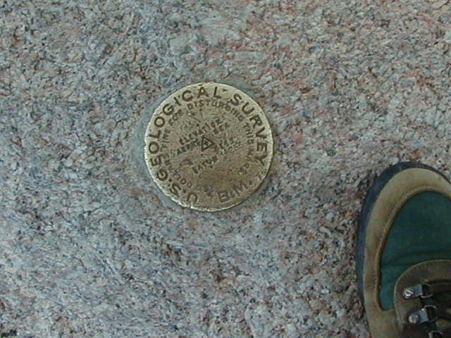
The survey mark at the
summit of Longs Peak (14,255 ft).
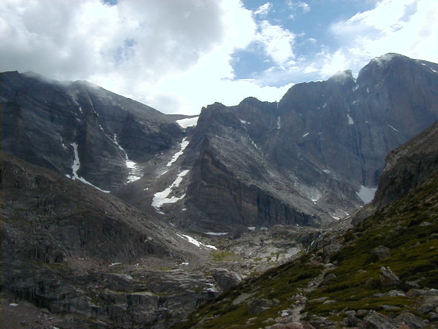
The view of Mount Meeker
(left) and Longs Peak (right) from the Chasm Lake junction.
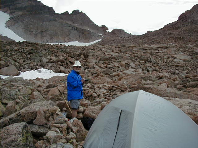
Dan and our cozy hotel
at the Boulderfield.
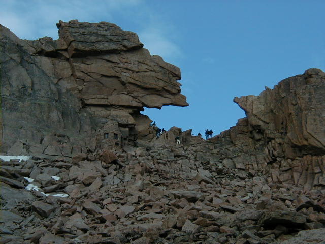
The Keyhole. The stone
hut to the lower left is the Agnes Vaille Memorial.
Leaving the Keyhole
and starting into Ledges.
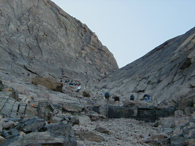
Looking up the Trough.
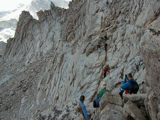
Narrows, as its name
indicates, is pretty much a one-way street.
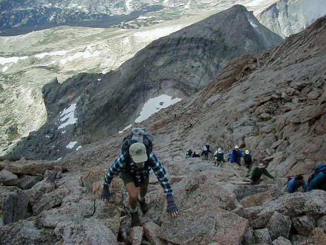
Looking down the Homestretch.
At the top awaits the summit we are about to claim.
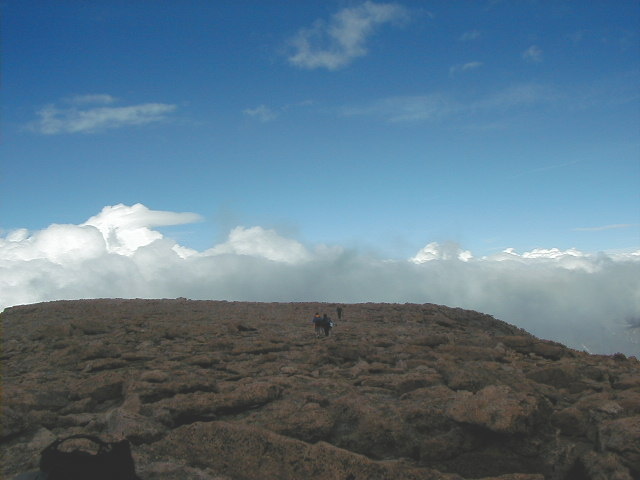
The summit of Longs
Peak (14,255 ft) is very flat.
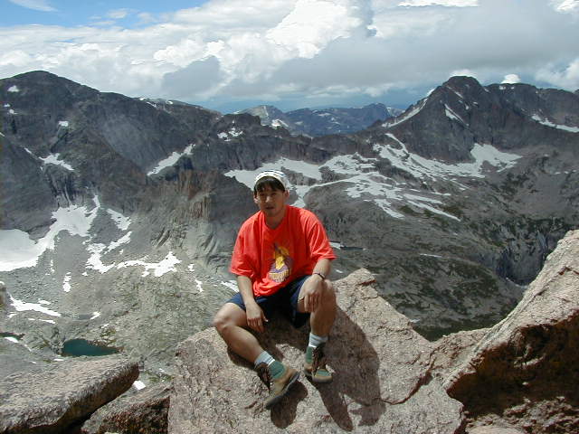
One last look into
Glacier Gorge from the Keyhole. To the left of me is Chiefs
Head Peak and Green Lake below.
|